Latest News
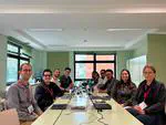
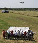
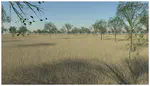
On June 23rd-25st, the first experimental field campaign using our THEMIS artificial target took place at the Centre wallon de Recherches agronomiques (CRA-W ) in Gembloux, Belgium.
The campaign was carried out as part of the Fiducial Reference Measurements for Vegetation (FRM4Veg) project, funded by the European Space Agency (ESA) and led by National Physical Laboratory (NPL). Its primary objective is to establish protocols for traceable in situ measurements of vegetation-related parameters, such as surface reflectance, in support of Earth observation satellite calibration and validation.
We are pleased to announce that the Eradiate Workshop 2026 will take place on 2nd–3rd December 2026 at ESA/ESRIN in Frascati, Italy. Participation is free, but registration is mandatory!
This two-day hybrid event will introduce participants to Eradiate from a conceptual and practical point of view. The programme includes:
We are happy to report that the paper describing the first stable release of Eradiate (v1.0.0) ("Eradiate: an accurate and flexible radiative transfer model for earth observation and atmospheric science, Leroy et al.") is now published in the open-access journal Geoscientific Model Development. We thank all those who made this possible: current and past team members, funding entities, users, and reviewers. This is the closing of a chapter in Eradiate’s lifecycle, and the opening of a new one.
We’re proud to share that Rayference has been awarded the Label Entreprise Ecodynamique / Ecodynamische Onderneming by the Brussels-Capital Region 🌱
This official recognition highlights our commitment to reducing the environmental impact of our activities and integrating sustainable practices, in line with our values and vision.
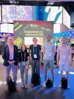
Earlier this month, Rayference participated in the European Geosciences Union General Assembly (EGU 2026) in Vienna, where we presented recent work from the 3DREAMS and SATACI projects.
The conference was a great opportunity to exchange ideas with researchers and partners working on atmospheric remote sensing, aerosol retrieval, and aerosol–cloud interactions.
We just released Eradiate v1.1.0, available on GitHub! This is the result of 6 months of development, during which we reduced the technical debt induced by our dependency tree, but also implemented new features.
Last week, Rayference participated in the European Space Agency - ESA DigitalTwinEarth Components: Open Science Meeting 2026 in ESRIN - alongside the DTE S2GOS (https://dte-s2gos.rayference.eu/) mid-term review meeting, an important milestone to reflect on progress, alignment, and next steps within the project.
The SATRISE journey started back in November 2025!
SATRISE is an European Space Agency - ESA-funded innovation project that brings together advanced Earth Observation satellite data and state-of-the-art 3D simulation to redefine how solar irradiance is estimated for photovoltaic (PV) systems. By combining Rayference’s CISAR algorithm with LuciSun’s GPU-based 3D modelling tool, LuSim, SATRISE aims to deliver unprecedented accuracy in solar resource assessment for complex PV applications such as bifacial PV, agrivoltaics, urban PV, and building-integrated photovoltaics (BIPV).